|
Forecast
Radar
Pittsburgh Radar Status
Alternate Radar
Satellite
Hazards Map (Local)
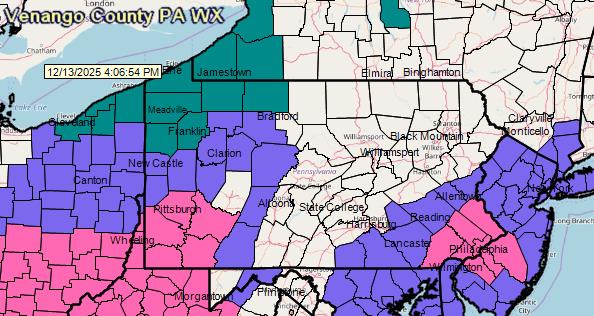
Hazards Map (U.S.)
Area Forecast Discussion
Warnings
Special Weather Statements
Hazardous Weather Outlook
Public Information Statement
Air Quality
Space Weather
Convective Outlooks:
Day 1
Day 2
Day 3
Days 4-8
Great Lakes Water Levels
Flood Potential Outlook
Daily Hydrometeorological Data Summary
Hydrologic Statement
Hydrologic Summary
Area Rainfall Report
Quantitive Precipitation Forecast Discussion
Rain Outlook
Excessive Rain Outlook
Exessive Rainfall Discussion
U.S. River Flood Outlook Map
Surface Analysis Maps
Local Storm Reports (All NWS Pittsburgh areas)
Fire Weather Outlook
Mesoscale Discussions - All States
Ultraviolet Index Map
Child Amber Alerts - All States
|
Forecast for Venango County
Untitled Document
Venango-
Including the cities of Oil City and Franklin
100 AM EDT Sat May 18 2024

.OVERNIGHT...Considerable cloudiness with a 50 percent chance of
showers. Patchy fog. Near steady temperature in the upper 50s.
South winds around 5 mph.
.TODAY...Mostly cloudy in the morning, then becoming partly
cloudy. Patchy fog in the morning. Highs in the mid 70s.
Southwest winds around 5 mph.
.TONIGHT...Partly cloudy. Lows in the mid 50s. Southeast winds
around 5 mph.
.SUNDAY...Partly cloudy. Highs in the upper 70s. East winds
around 5 mph, becoming north in the afternoon.
.SUNDAY NIGHT...Clear. Lows in the mid 50s. North winds around
5 mph, becoming east after midnight.
.MONDAY...Mostly sunny. Warm with highs in the lower 80s.
.MONDAY NIGHT...Mainly clear. Lows in the upper 50s.
.TUESDAY...Mostly sunny. Warm with highs in the lower 80s.
.TUESDAY NIGHT...Mainly clear. Warm with lows in the lower 60s.
.WEDNESDAY...Mostly sunny with a chance of showers in the
morning, then partly sunny with showers likely with a chance of
thunderstorms in the afternoon. Warm with highs in the lower 80s.
Chance of rain 70 percent.
.WEDNESDAY NIGHT...Showers likely with a chance of thunderstorms.
Lows in the upper 50s. Chance of rain 70 percent.
.THURSDAY...A chance of thunderstorms in the morning. Partly
sunny with a chance of showers. Highs in the lower 70s. Chance of
rain 50 percent.
.THURSDAY NIGHT...Partly cloudy. A chance of showers in the
evening. Lows in the upper 40s. Chance of rain 50 percent.
.FRIDAY...Partly cloudy in the morning, then becoming partly
sunny. Highs in the upper 60s.
 <>
<> <>
<>
|

https://s.w-x.co/staticmaps/wu/wxtype/none/usa/animate.png

Click on an image for larger view. |
|